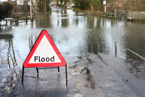
Moist tropical air is brought heavy rain to parts of north Wales, northwest England and southwest Scotland on Saturday and Sunday, before clearing to the southeast today as we head into an unsettled week for many. Met Office National Severe Weather Warnings have been issued for rain for these areas, while the Environment Agency, Natural Resource Wales (NRW) and the Scottish Environment Protection Agency (SEPA) are assessing the potential flood risk.
The tropical air is all that remains of ex-hurricane Kate. This hurricane developed over the Western Atlantic, gradually weakened as it moved across the ocean, and has now become an Atlantic depression.
This slow-moving frontal system is bringing moist tropical air across the UK from the west resulting in some heavy and persistent rain with windy conditions, especially over exposed west facing hills.
Many parts of the warning area could see 50-80 mm of rain, with some of the more exposed parts of north Wales and northwest England possibly seeing as much as 200-250 mm through this period. Even outside of the warning area for many it will be a blustery damp and chilly weekend
The Environment Agency is concerned that this amount of additional rainfall falling on to already saturated ground could well lead to flooding. Flood warnings have been issued for parts of northern England such as Cumbria.
NRW is planning to put flood risk management procedures in place if required and will issue Flood Alerts and Warnings if rivers reach trigger levels. The warnings are updated on the NRW website every 15 minutes.
The British Geological Survey (BGS) has expressed some concerns over the increased risk of landslips. Dr Helen Reeves, BGS Science Director said “Recent heavy rainfall has left much of the UK with saturated ground conditions. Continued and prolonged heavy rain is forecast on the already saturated ground making the chances of landslides more likely; particularly across parts of Scotland, Wales and northern England.”
The weather warnings will be kept under review and adjusted should the weather system change or develop and potential impacts vary.
During this period of unsettled weather, you are advised to stay up to date with the latest Met Office forecasts and National Severe Weather Warnings and find out what to do in severe weather so you can plan ahead for the coming weather.
You can report severe weather through the Met Office Weather Observations Website (WOW) as well as uploading photos and information via your mobile phone.
Throughout this unsettled spell Met Office forecasters and advisors are working round the clock with our partners to keep everyone up to date with the latest forecast information so they can plan and prepare for the expected weather.
© Met Office


